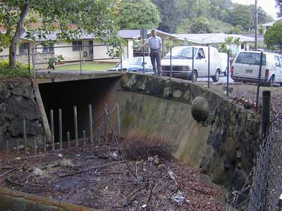
The concrete chute behind the Parkway Community Recreation Center (Photo 4 above) directs flow into a large box culvert beneath the lawn adjacent to the Center and under Mokulele Drive. The culvert is open (Photo 5) around a broad turn that carries flow through Parkway between concrete, vertical walls some 4-5 m high. This structure can be viewed from Mokulele Street in Parkway or the end of Koa Kahiko Street in Pikoiloa. The stream bed is a flat, concrete bottom with some sediment deposited particularly inside the curve as a bar supporting weedy growth such as primrose willow (Ludwigia octovalvis). Despite a base flow depth of only about 1 cm, large numbers of poeciliid fish (mostly shortfin molly -- Poecilia mexicana) are present feeding on a thin coating of algae and associated insect larvae.
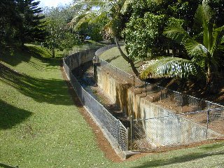
- Photo 5.
- The concrete culvert that carries Kawa Stream through the lower part of Parkway Development.
At the curve in this massive open box culvert a concrete pipe culvert conveys flow from the middle west branch, a short, intermittent stream draining the area around Kaneohe Elementary School.
Below this point, the culvert opens onto a stream segment characterized by mostly bedrock bottom and steep soil banks (see Photo 6). Water flows over low outcrops of basalt through a series of pools inhabited by large numbers of fishes: shortfin molly (P. mexicana), spiny armored catfish (Loricariidae), convict cichlid (Cichlasoma nigrofasciatum), and swordtail (Xiphophorus helleri). Near the lower end of this segment two species of aquatic plants (elodea -- Egeria densa and waterweed -- Hydrilla verticillata) appear in pools. The stream is now confined between steep banks of soil fill and weathered basalt, passing between houselots in the Pikoiloa tract.
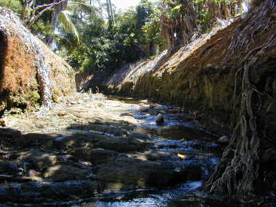
- Photo 6.
- Kawa Stream up from Namoku Street bridge (above the end of Akimala Place). Note steep banks shaped by bulldozer and basalt bedrock bed, both characteristic of the entire stream segment from the Parkway culvert to Namoku Street.
The character of the stream channel changes markedly below Namoku Street. A sloped bank, open concrete culvert extending downstream from the box culvert under the street broadens into a substantially wider channel. Here, the stream bed is mostly concrete rubble for a distance of many meters, as is the left bank. This material appears to have been dumped in the past from trucks gaining access off Namoku Place, and possibly pushed up the stream by bulldozer in an attempt to reduce stream bed and bank erosion below the concrete-lined section.
Not far downstream, the central branch is joined by a right bank tributary, the middle east branch, which drains much of the newer section of Pikoiloa over to Pohai Nani. This branch is perennial in the lower part and fed by street drains as well as small, intermittent branches. Storm flow in the hills behind the suburban development is conveyed to collecting basins such as that shown in Photo 7.
- Photo 7. Drain inlet at the top of Lipalu Street in Pikoiloa collects freshet flows from the forested watershed and directs water underground to on outlet elsewhere on Kawa Stream.